Sindh is a province of Pakistan. Located in the southeastern region of the country, Sindh is the third-largest province of Pakistan by land area and the second-largest province by population after Punjab. The Indus river is the main source of water for Sindh province and is also home to the delta. The delta is dependent on the freshwater from the Indus. Without this freshwater, there would be no delta and no livelihoods for millions of fishing communities. The River Indus is a pivotal water source for Sindh as it is the only source of freshwater that sustains the people, environments and economy of Sindh. The Indus River provides key water resources for Pakistan’s economy – especially the breadbasket of Punjab province, which accounts for most of the nation’s agricultural production, and Sindh.
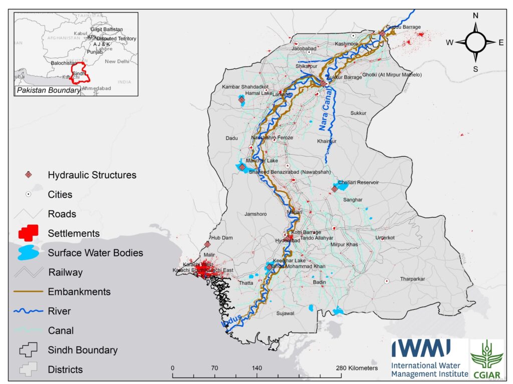
Irrigation Command Map
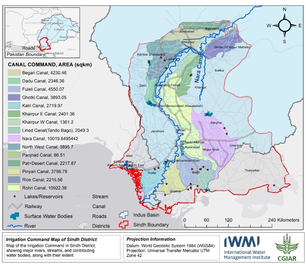
The Irrigation Command Map Sindh is a comprehensive geographic information system (GIS) map that provides a detailed overview of irrigation networks and water distribution channels in the Sindh province of Pakistan.
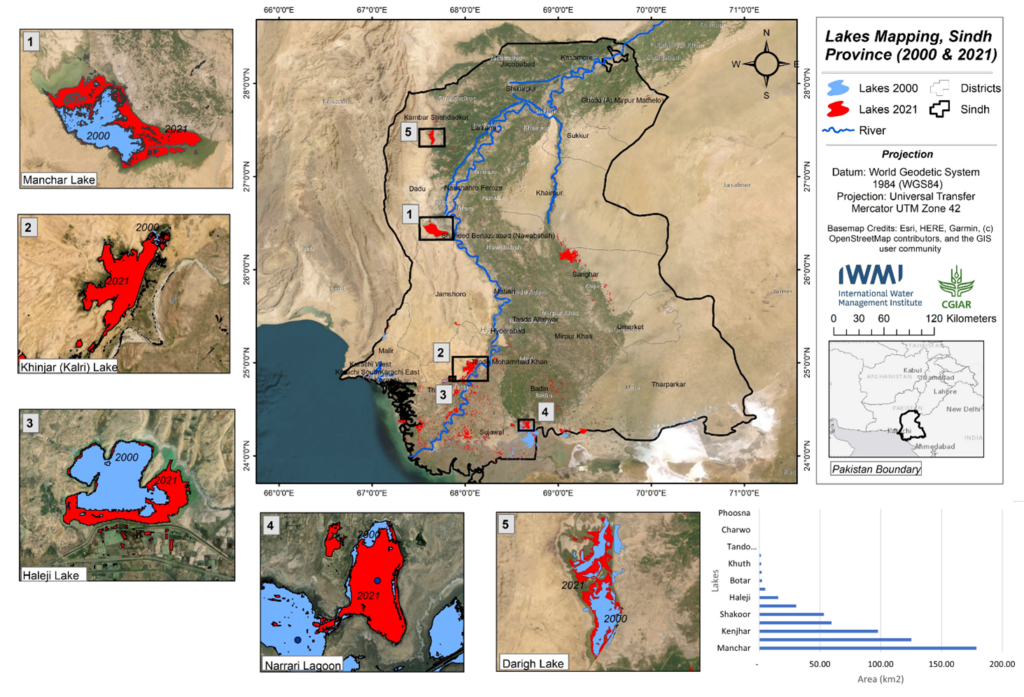
Multi Temporal Lakes detection and Mapping (2000 and 2021)
The Multi-Temporal Lakes Detection and Mapping project utilizes satellite imagery from 2000 and 2021 to identify and map lakes, studying changes in their distribution and size over the two time periods.