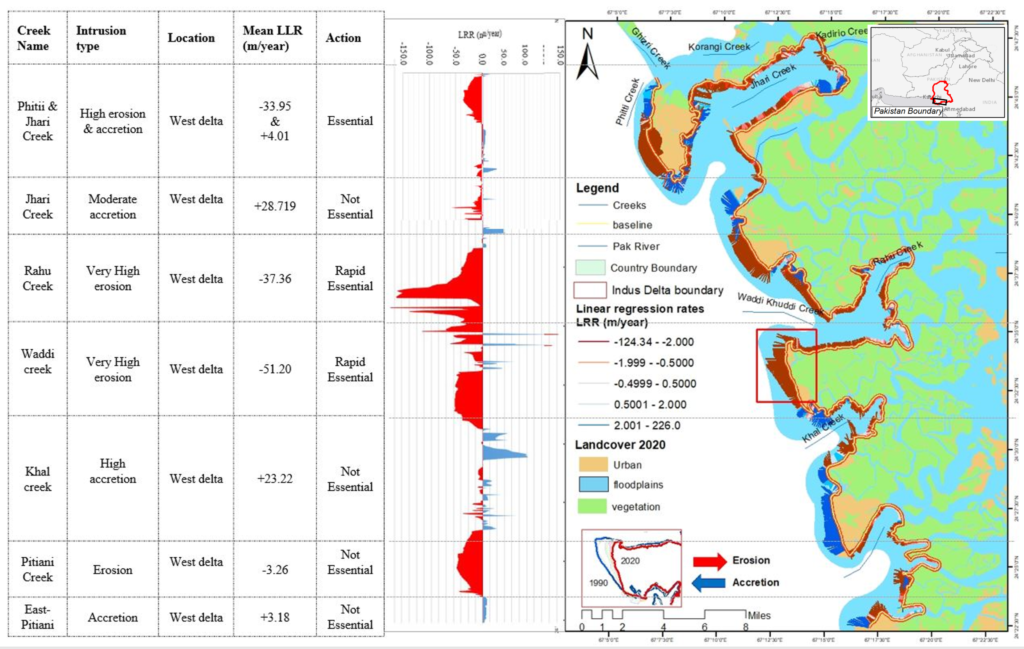
Western Indus delta, Sindh coastline assessment indicate it is a highly risked area towards erosion with an average LRR -10.09 ± 1.61m/year, mainly contributed by receding properties of land towards the sea. Results also indicate has high erosion at the Phitii creek area with an average rate of -33.95m/year, -37.36m/year for Rahu creek, with experiencing tremendous erosion and -3.26m/year at the Pitiani creek, respectively for the last three decades (1990-2020). Moreover, out of the 180.7km area, the highest observed erosion rate was at Phitii, Rahu, and Waddi creek by about 148.8km, where the land was badly eroded along the western coast.
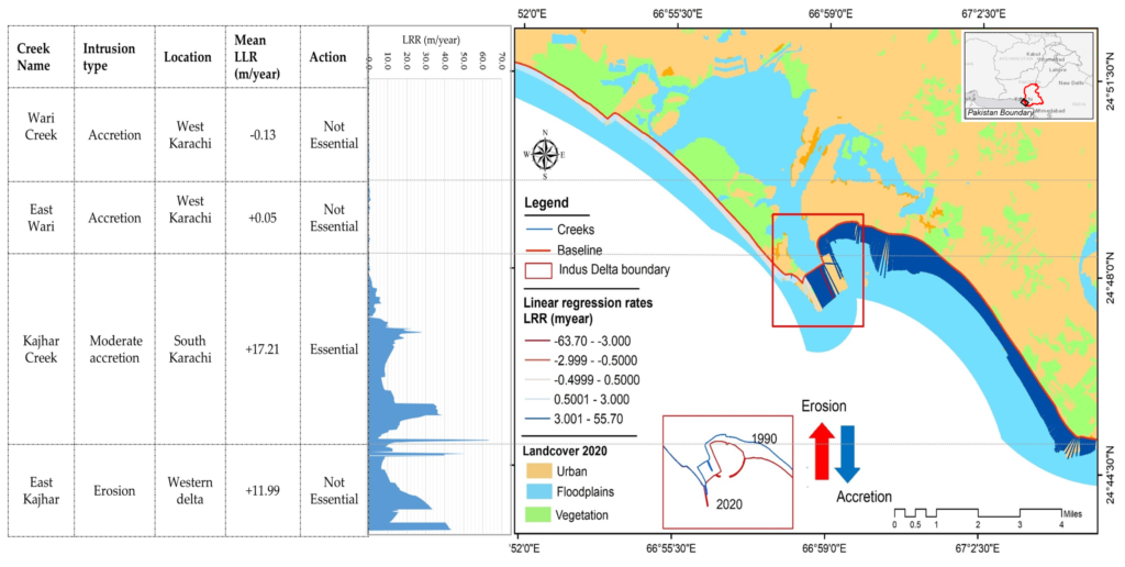
Accretion and Erosion Analysis: Northwest Karachi, Sindh
The average observed progressive rate was 7.28±1.15m/year recorded at the Sandspit area, and the process of accretion is dominant along the western coast. Overall estimated shoreline change rate was with mean LRR of 17.21 and 11.99 m/year, with an increment in positive values. The statistical results showed that LRR is positive for northwest part of Karachi particularly towards the Kajhar creek area with an observed +17.21m/year change rate. Whereas a small amount of erosion with -0.13m/year was observed around the Wari creek area.
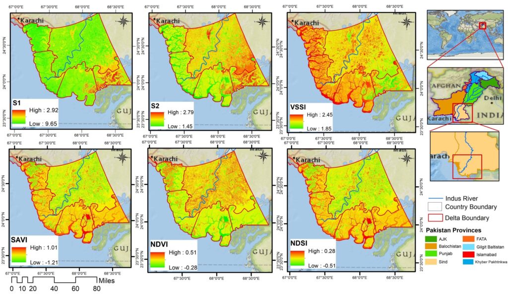
Comparative Analysis of Satellite derived Indices
Comparative Analysis of Satellite-Derived Indices project involves the assessment and comparison of various remote sensing indices derived from satellite data.